November 14, 2026
How Drone Data Capture Moves from Flight to Delivery
By @aerialprogress
Drone technology has changed how businesses collect visual information from above. But capturing images or video is only one part of the process. The real value comes when raw aerial data is transformed into something usable: maps, models, measurements, and reports. That transition, from flight to delivery, is what makes aerial data capture a complete service rather than just a flight.
What aerial data capture involves
Aerial data capture is the process of using a drone to gather visual or sensor-based information from the air. This can mean standard RGB photography, multispectral imagery, thermal video, or LiDAR point clouds. Each type of data serves a different purpose. Construction teams might need orthomosaic maps to track site progress. Farmers use multispectral data to assess crop health. Surveyors rely on precise topographic models to plan drainage or cut-and-fill volumes.
The key point is that capture is only the first step. Once the drone lands, the work of turning those files into actionable information begins. That work includes uploading, processing, organizing, visualizing, comparing, measuring, and sharing the data. A platform like the one at nationaldroneservices.net supports that entire pipeline, from raw uploads to finished deliverables.
Flight planning sets the foundation
Before any drone takes off, the capture mission must be planned. This involves defining the area of interest, choosing the right sensor, setting altitude and overlap parameters, and accounting for weather and airspace restrictions. Good flight planning ensures that the data collected will cover the entire site without gaps and at the resolution needed for the intended analysis. Poor planning often leads to missing data, which means a return flight or incomplete results.
For large areas, automated flight paths are common. The drone follows a grid pattern, capturing images at regular intervals. Overlap between images, usually 70-80% front overlap and 60-70% side overlap, allows photogrammetry software to stitch them into a single seamless map or model. This technique works for both 2D orthomosaics and 3D point clouds.
The capture itself: what happens in the air
During the flight, the drone records images or sensor data along with GPS coordinates and orientation data. Modern drones store this information in the image metadata. That metadata is essential for later processing because it tells the software exactly where each image was taken and what angle the camera was pointing. Without good metadata, alignment becomes guesswork and accuracy suffers.
For thermal data, the drone captures temperature values across a surface. For LiDAR, the sensor emits laser pulses and measures return times to build a dense cloud of 3D points. Each type of capture has its own best practices: thermal flights often require time-of-day planning to avoid solar heating, while LiDAR flights need stable light and minimal vegetation interference.
Once the drone lands, the storage media contains the raw files. Depending on mission length and sensor type, this could be hundreds or thousands of individual files. The next stage is transfer and processing.
From media to processing pipeline
Raw files are copied to a computer or cloud platform. At this stage, nothing has been stitched or analyzed. The operator reviews the data for quality: Are all images present? Is the focus sharp? Are there any corrupted files? If the flight was long, the operator might also check battery logs to confirm stable power during capture.
Once verified, the data enters a processing pipeline. For photogrammetry, software detects common points between overlapping images and computes camera positions and terrain models. This produces an orthomosaic: a georeferenced image where every pixel corresponds to a real-world coordinate. For LiDAR, software filters noise and classifies points into ground, vegetation, and structures. For thermal data, the software assigns temperature values to each pixel based on calibration data.
Processing can be computationally intensive. Large datasets may take hours to complete on a powerful workstation or cloud server. Some platforms offer automated processing, which reduces the need for specialized staff. Others require manual tuning of parameters like point density or surface smoothing.
Organizing and visualizing the results
After processing, the output files need to be organized. A single project might generate an orthomosaic, a digital elevation model, a point cloud, a contour map, and a volume calculation report. Keeping these files in a logical structure is important for future reference and sharing. Good platforms allow users to tag, sort, and search project data by date, location, or type.
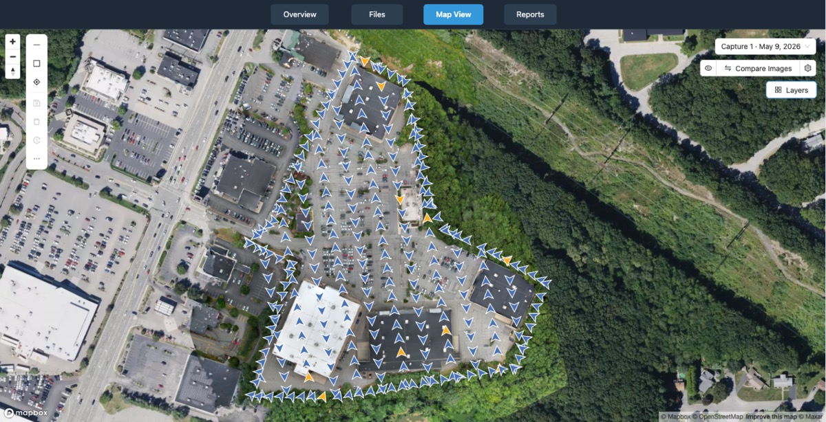
Visualization is where the data becomes useful. Instead of looking at raw coordinates, users see a color-coded elevation map, a 3D model of a stockpile, or a thermal image with temperature legends. Interactive viewers let users pan, zoom, and measure distances or areas directly on the model. Some platforms also support overlaying multiple datasets for comparison: for example, comparing a current orthomosaic with one from last month to see change over time.
Measuring and comparing
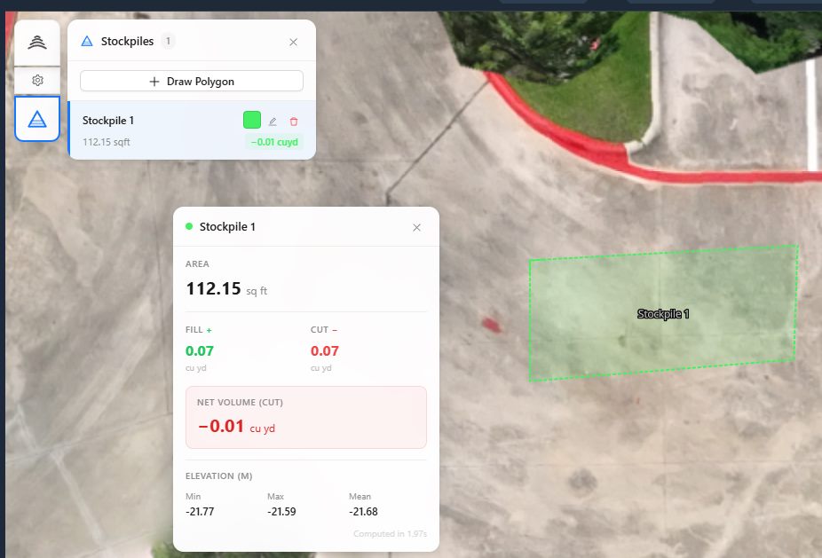
Measurement tools turn visual data into quantifiable information. Users can calculate the volume of a gravel pile, the area of a roof, or the distance between two points. For construction, this means tracking cut-and-fill volumes across weeks. For mining, it means monitoring stockpile inventories. For environmental work, it means measuring erosion or vegetation growth.
Comparison tools go a step further. By aligning two datasets from different dates, users can see exactly where and how much change occurred. Color maps highlight areas of gain or loss, and reports automatically calculate differences. This is especially valuable for site monitoring, where small changes can indicate problems before they become visible on the ground.
Sharing and collaboration
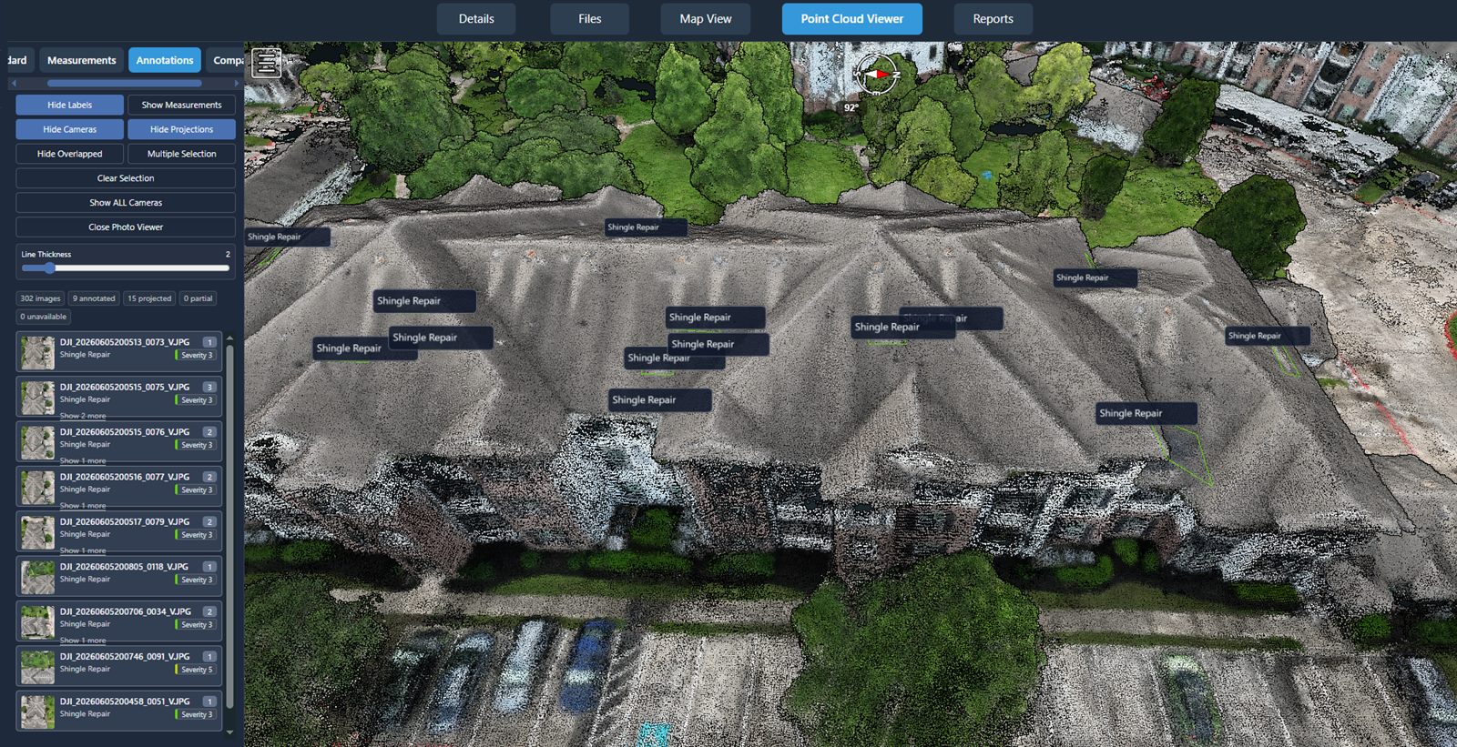
Captured and processed data has limited value if it stays on one person's computer. Sharing is a critical step. Modern platforms allow users to generate shareable links or embed viewers in reports. Project stakeholders can access the data through a web browser without needing specialized software. Comments and annotations can be added directly to the model, making collaboration easier.
National Drone Services, as a nationwide service provider, offers a platform that covers this entire workflow. From uploading raw files to sharing final results, the system is designed to handle the full cycle. This approach saves time and reduces the risk of data loss or miscommunication between field teams and office staff.
What this means for the reader
If you are responsible for site inspection, surveying, agriculture, or any field that benefits from aerial views, understanding the full pipeline helps you choose the right tools and partners. The quality of your final deliverable depends on every step: flight planning, capture, processing, organization, and sharing. A platform that integrates these stages into one workflow simplifies your job and ensures consistency.
One of the hidden benefits of a well-structured aerial data capture pipeline is repeatability. When you have a standard process, you can compare results from different dates with confidence. You can also scale up from a single site to dozens without reinventing the workflow each time. That consistency is what turns drone data from a novelty into a reliable business tool.
In practice, many organizations start with a single project to test the approach. They learn what works for their terrain, their sensor, and their analysis needs. Over time, they build a library of projects that can be revisited for trend analysis or compliance reporting. Having a platform that stores and indexes all that data makes it easy to retrieve and reuse later.
For those considering aerial data capture for the first time, it is worth investing in the whole process, not just the flight. A drone is just a camera on a flying platform. The real value comes from what you do with the images after they are captured. A good platform, like the one offered by National Drone Services, handles the processing, organization, and sharing so you can focus on interpreting the results and making decisions.
Ultimately, the move from flight to delivery is about closing the gap between raw data and actionable insight. With the right planning, capture, and processing pipeline, aerial data capture becomes a predictable, repeatable service that delivers consistent results. That is what turns a single flight into a long-term asset for your business.
National Drone Services on social media
 Facebook
❧